mBDL 1.19.3
Continue to app
Free Version
Publisher Description


mBDL - mBDL is an application that provides map resources of the Data Bank on the Forests.
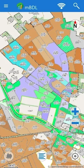
The mBDL (Mobile Forest Data Bank) application enables direct access to forest maps on phones and tablets. The basic content of the application are forest thematic BDL maps, such as: basic map, tree stand, ownership forms, forest habitats, plant communities, hunting map, tourist development map and fire hazard map and temporary bans on entering forests. In addition to industry maps, the user has the option of displaying predefined raster backgrounds, e.g. a topographic map or aerial/satellite orthophotomap, as well as maps from external WMS services. The addresses of the most popular services, e.g. cadastral data, orthophotomap or GDOŚ service, are stored in the application permanently, which makes their use easier. Other, any WMS services can be connected by entering a specific URL address, which is then remembered in the application.
After downloading the appropriate data, the application also works when there is no connection to the Internet. The mechanism of downloading data for offline work enables the use of maps of forest districts and national parks. Together with the maps, which are saved in raster form, vector data with descriptive attributes are downloaded for PGL LP forests.
From the level of the mBDL application, the user has online access to a full taxation description for forests of all ownership forms. Such a description includes species of trees and shrubs occurring in a given place, their detailed description, forest address, economic indications and many other information.
The application is additionally equipped with a number of functionalities useful in the field: area and distance measurement, recording a point from a GPS location or from a map indication, recording a route and simple navigation to a given point. Saved waypoints and routes can be exported as a KML file, sent to the world in any way or imported on another device on which the mBDL application is also installed.
In mBDL, you can search for forest divisions based on the so-called forest address, cadastral parcels or point by means of its coordinates.
In the Help menu, there is also a manual describing the basic functionalities, which is worth getting acquainted with at the beginning of using the application.
Declaration of availability: https://www.bdl.lasy.gov.pl/portal/deklaracja-mbdl
About mBDL
mBDL is a free app for Android published in the Geography list of apps, part of Education.
The company that develops mBDL is Biuro Urządzania Lasu i Geodezji Leśnej. The latest version released by its developer is 1.19.3.
To install mBDL on your Android device, just click the green Continue To App button above to start the installation process. The app is listed on our website since 2024-03-06 and was downloaded 1 times. We have already checked if the download link is safe, however for your own protection we recommend that you scan the downloaded app with your antivirus. Your antivirus may detect the mBDL as malware as malware if the download link to pl.gov.lasy.bdl is broken.
How to install mBDL on your Android device:
- Click on the Continue To App button on our website. This will redirect you to Google Play.
- Once the mBDL is shown in the Google Play listing of your Android device, you can start its download and installation. Tap on the Install button located below the search bar and to the right of the app icon.
- A pop-up window with the permissions required by mBDL will be shown. Click on Accept to continue the process.
- mBDL will be downloaded onto your device, displaying a progress. Once the download completes, the installation will start and you'll get a notification after the installation is finished.
